Cyclist
UK ride: To the Golf Ball
The ancient graveyard in the village of Keir Mill is packed with moss-covered headstones and we have to battle through thigh-high grass to find the one we’re after. It’s the largest headstone of them all and it’s dedicated to the village blacksmith credited with designing the world’s first pedal-driven bicycle.
Every square inch of the stone is inscribed with text that gets smaller towards the bottom as if the engraver suddenly realised he was running out of space.
I’m expecting to read a florid account of Kirkpatrick Macmillan’s life – how he rode his wooden machine with steel-rimmed wheels the 70 miles to Glasgow on rutted country tracks in 1842 – but instead it’s a sombre list of all the family members who are buried here.
I have to flatten the grass at the foot of the headstone to read the last couple of lines, where Macmillan’s claim to fame is revealed almost as an afterthought: ‘Kirkpatrick Macmillan who died 26th January 1878 aged 65 years. Inventor of the Bicycle.’

With me is Warren Sanders of Galloway Cycling Holidays, who encourages his guests to make pilgrimages here during their rides: ‘He’s very much an unsung hero but we’ve tried to spread the love,’ he says. ‘He should be on our banknotes.’
From the graveyard, we continue to the whitewashed building that was Macmillan’s ‘smiddy’ where he forged metal, shoed horses, designed bicycles and even occasionally pulled teeth. I wonder what his creative mind would make of the smartphones and weather apps we’re consulting now. It’s two weeks until the summer solstice yet a highly unusual Arctic airflow has forced Britain to put the heating on.

Here at the foot of the Lowther Hills in Scotland it’s 10°C, but 600 metres above us, where we are heading, it’s below zero. Our jersey pockets bulge with extra layers, warmers and gloves. We can see our goal on the crest of a distant hill – a white, spherical structure known locally as ‘The Golf Ball’. It’s shimmering in a pool of sunlight that our apps inform us will last only until midday, at which point a weather front from the west will move in.
High society
Contrary to popular belief, Scotland’s highest paved road isn’t in the Highlands but is here in Dumfries and Galloway, less than an hour’s drive from the border with England. It’s not as well-known as the tourist routes that traverse the mountains further north, largely because it’s closed to motorised traffic. But first we have to ride up to Scotland’s highest village, Wanlockhead, via the beautiful, natural corridor that is the Mennock Pass.
After the shock of its introductory steep ramps, the road levels off in a wide valley flanked by slopes that, in late summer, are ablaze with purple heather but for now are a carpet of iridescent green punctuated by the occasional ‘O’ of a circular drystone sheepfold. The only blemishes are the motorhomes and caravans sporadically parked up on the wide grass verge. The occupants of these, Warren says, are usually drawn here by the lure of a precious and shiny metal glittering at the bottom of the valley streams. Sure enough, we spot a couple knee-deep in water and shaking sieves.
Panning for gold here dates back to the 16th century when it was used in the minting of coins during the reign of Mary, Queen of Scots. Nuggets peppered these hillsides like cow pats. Flakes of gold – and the occasional nugget – still turn up, although you need a licence to go prospecting.
The road continues climbing even as we pass the sign welcoming us to the ‘Highest Village in Scotland’ and it’s several hundred more metres before we reach the turn-off to the private road, open to walkers and cyclists only, that will take us to the summit. We’ve climbed 300 vertical metres and are only halfway there.

This private road is a 6km ribbon of bliss. With the exception of a couple of short sections, it’s well-surfaced tarmac that snakes lazily between the Lowther Hills to the dual radio masts that mark the highest peak, Green Lowther, at 732m. Once the village has slipped out of sight all we can see is an endless vista of whale-backed ridges being swept by fast-moving shadows of clouds. With no other traffic to distract us, it feels like a cyclist’s nirvana.
After 4km, the steepest ramp delivers us to ‘The Golf Ball’, a radar station that’s part of Britain’s air traffic control network. From here, the road continues straight as an arrow to the radio masts on the next hill. We arrive at the same time as the storm we’ve been racing.

In between struggling to put on my rainproof jacket – my fourth layer of the day – I spot a door that is slightly ajar in a brick building beneath one of the masts. I push it open to find an empty room with a bare concrete floor and an abundance of plug sockets that makes me wish I’d brought my phone charger.
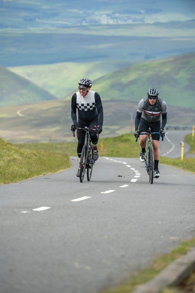
We are just pushing the door closed behind us when we spot another cyclist arriving, the only other human being we have seen since leaving Wanlockhead. We wave him in our direction and he dumps his ageing mountain bike against the wall before joining us and introducing himself as 72-year-old John Moore. He’s driven the 60 miles from Selkirk to Wanlockhead after hearing this was Scotland’s highest road.

‘I’m ticking off all the big climbs,’ he says. ‘I did the Bealach na Bà a few weeks ago. It was fine but there was traffic and a lot of the drivers didn’t know how to use the passing places. This is much better.’
Then John says he has to get going as his wife’s waiting for him in the car below.
Metal fatigue
We choose to wait in our shelter a bit longer for the rain and wind to subside, and when we arrive back in Wanlockhead it’s time for lunch. There’s the chance to eat at ‘The Highest Pub in Scotland’ but Warren recommends the tearoom at the Lead Mining Museum (these hills were once rich in a variety of minerals, not just gold).

Inside, a group of motorcyclists are celebrating their ascent to such rarefied heights with nothing but huge, piston-pumping engines to propel them. One of them comes over, but instead of a friendly chat he wants to provoke a ‘discussion’ about whether the 1.5m rule for motorists passing cyclists is measured from the rider or the kerb.
The encounter reminds me of a chapter from Graeme Obree’s autobiography, Flying Scotsman. He used to regularly cycle up here but thinks the place ‘has gone right downhill in recent times from the perspective of our cycling club […] People often arrive by car, such is the current state of affairs.’

We’ve actually seen very few cars so far today, but I understand Obree’s despair. And I feel sorry for our motorcyclist friend with the poor grasp of the Highway Code. He’ll never know the joy of riding those lonely, beautiful six kilometres on the highest stretch of tarmac in Scotland.
Wind and water
Our ride continues through the neighbouring village of Leadhills – home to the ‘The Highest Hotel in Scotland’ – before we turn right past ‘The Highest Golf Course in Scotland’ and begin a sweeping descent towards an eclectic convergence of infrastructure: the M74 motorway; the west coast main line railway; the source of the River Clyde; and, looming above them all, the skeletal stalks of hundreds of wind turbines.

The Clyde Wind Farm is one of the largest in Europe and the suitability of its location becomes painfully apparent as we turn right into a strong, westerly headwind that will dent our pace for the next 15km. By then we have arrived at the Dalveen Pass, which tips us into a cauldron of steep, flowing slopes untroubled by anything manmade or modern. Not for the first time today, we don’t even see any other traffic.

Nestled in a nook of the hills beneath a cluster of oak trees is the ancient hamlet of Durisdeer, which lies on the other side of a ford. I think it would look spectacular to ride through the ford, sending up jets of spray as we cross, but decide that a quick safety check would be prudent before launching into the water.
‘There are cobbles! Covered in moss! Underwater!’ I relay back to Warren. We take the footbridge instead.

We eventually join the pink-surfaced, tree-lined driveway to Drumlanrig Castle, just a few kilometres from the end of our ride. I’ve ridden this road before in 2013 when I took part in the Tour of Britain sportive from Peebles. The next day Elia Viviani won the opening stage in front of the sandstone facade of the 17th century castle.
The castle brings our ride full circle. It’s where a young assistant blacksmith learned his trade before setting up business in his home village. He went on to design the machine that would change the lives of millions of people around the world and make today’s adventure possible.

Wee bit hill and glen
Five other must-do, away-from-the-crowds Scottish climbs
Mam Ratagan
Distance 4.4 km. Elevation 335m. Av gradient 7.7%. Max gradient 16.4%
Starting on the shores of Loch Duich just off the A87, this is the less-travelled route (via a seasonal turntable ferry at Glenelg) to the Isle of Skye. Most of it is through forest, all of it is steep, but the summit offers an unforgettable panorama of mountains and lochs.
Kenmore Hill
Distance 5km. Elevation 412m. Av gradient 8%. Max gradient 16.8%
A fierce climb on a narrow lane from the village of Kenmore at the eastern end of Loch Tay that delivers you into the beautiful, remote Glen Quaich. It gets easier about halfway up, trust us (although it’s all relative).
Cairn o’ Mount
Distance 3.3km. Elevation 313m. Av gradient 9.8%. Max gradient 16.6%
Like a Caledonian Ventoux, this giant rises in solitary splendour from the nearby Grampian mountains just north of the Aberdeenshire village of Fettercairn. The ‘16%’ warning sign at the start sets the tone. There is a kilometre of false flat in the middle before the hurt resumes. Featured in the 2021 Tour of Britain.
Maovally
Distance 5km. Elevation 320m. Av gradient 6.5%. Max gradient 10.7%
A private road (open to walkers and cyclists) that services two power stations at the northern tip of Loch Shin in Sutherland, this is as beautiful and remote as it gets. The road is a dead end, unless you’ve got a gravel bike in which case it’s possible to make a loop via the stunning Glen Cassley.
Craigowl Hill
Distance 3.5km. Elevation 318m. Av gradient 8.5%. Max gradient 22.8%
Another private road, this monster lurks a few clicks north of Dundee. Don’t be deceived by how gentle its long, opening straight looks – you’ll be empty (but elated) by the time you scale the summit overlooking Dundee and the River Tay. Watch out for sheep on the way back down.

How we did it
Travel
The nearest train stations to the start of the ride are Dumfries and Sanquhar, both roughly 25km away and both served by Scotrail services on the Glasgow-Carlisle route. A bit further away (40km) is Lockerbie on the west coast main line.
Accommodation
We stayed at the Buccleuch & Queensferry Arms Hotel (bqahotel.com) in Thornhill, where our ride started. The bike-friendly hotel in the centre of the village offers spacious, luxury rooms, a bar full of leather armchairs, beer garden and restaurant serving high-quality local produce. We can recommend the rack of lamb for dinner and the full Scottish breakfast.
Thanks
Many thanks to Warren Sanders of Galloway Cycling Holidays (gallowaycycling.com), which offers guided and self-guided road and gravel tours and can arrange transfers, bike hire, accommodation and meals. Thanks also to Esther Tacke at Galloway and Southern Ayrshire Biosphere (gsabiosphere.org.uk) for introducing us to various local points of interest, including walks, art installations, waterfalls and the Belted Galloway breed of cattle. For more info about the area, visit scotlandstartshere.com.
The post UK ride: To the Golf Ball appeared first on Cyclist.